After his terrible ordeal in Gethsemane, Jesus was arrested, taken from Gethsemane on the east side of the city, down into the Kidron Valley and on into the Hinnom Valley on the south side of the city and was very likely brought up these steps to the Government buildings of the 2nd temple period... a distance of about a mile of treacherous ups and downs.
It is, no doubt hard to judge distance from this small photo, but Jesus was compelled to climb up hundreds of feet of stairs up to the dungeons, judgement halls, other government buildings and Caiaphas' palace.
He was surely flanked by Jewish or Roman soldiers assigned to carry out the orders of the Sanhedrin of Jerusalem. I can imagine a small group of his disciples huddled at the bottom of the stairs, keeping a good distance behind the soldiers, to avoid drawing attention to themselves... but also afraid to let the Savior out of their sight.
They had to have felt it their duty to stick close to their Master, possibly defend Him, if opportunity arose.
Here you can see some restoration work of what much have been imposing government buildings of Jesus' day. Impressive sized foundation/ building stones are littered all over this area.
I gained a little insight and sympathy for Peter, while I was here. Government buildings, particularly of oppressive regimes, tend to be far more imposing than is needful, for the very purpose of inspiring awe and fear in their subjects.
Here are more ruins and foundations, with their littering of stones. I enjoyed trying to visualize what the buildings must have looked like. Everything in Jerusalem is built on hills. The compounding effect of what appears to be building on building, with porches, connecting walkways, must have been both beautiful and terrifying, depending on the situation. I tried to imagine the apostles trying to "fit in". They must have felt terribly out of place.

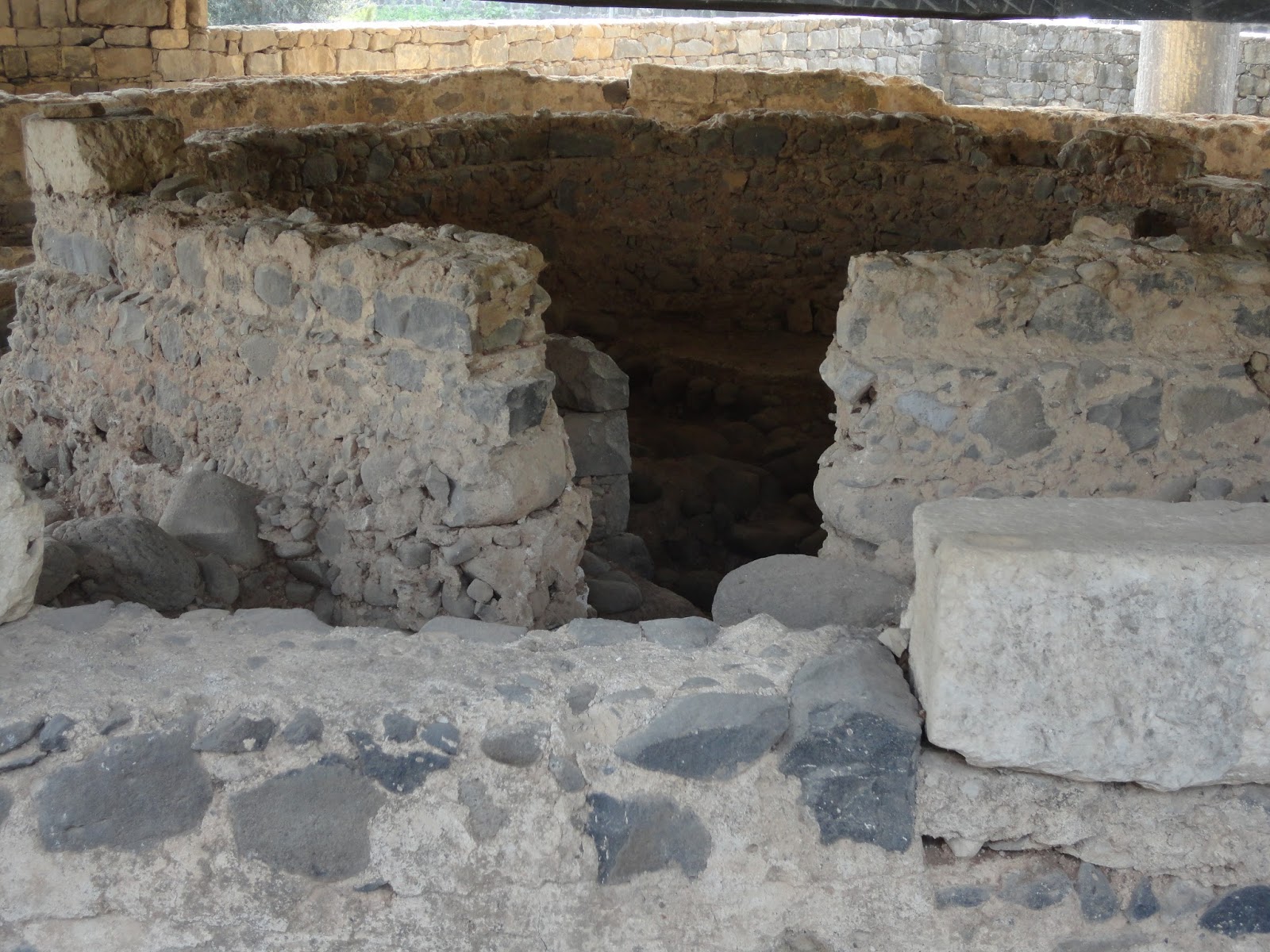
This is looking down the hall into the dungeon area. Rings and chains are hooked to the walls. It is dark and musty. I wish I had taken photo's of the faithful hearted who here were worshipping and singing. I remembered that all through that night, whether in a garden, a dungeon, a courtroom or Caiaphas' judgement hall, that not only was Jesus calmly answering the rude, inconsiderate inquiries of his captors, looking past their snide, victorious, obscene comments of conquest and perceived victory; He was also continuing with the extreme pain of the atonement. Humbly submitting as face after face, appeared for repentance and healing.
This is actually where you enter. See the stones in the foreground, evidence of more buildings, palaces, etc. The little church, with the gray roof, to the right covers the dungeons and partial floor of one of the judgement halls. The pavilion, covers models of crusader era Jerusalem. The city section beyond the Church is the Palestinian town of Silwan.
This vacant area is thought to have been the former site of Caiphus' palace. Foundation stones cover the area, but you can not see them because the grass is too high.


 The Hyraxes are about the size of a cat.
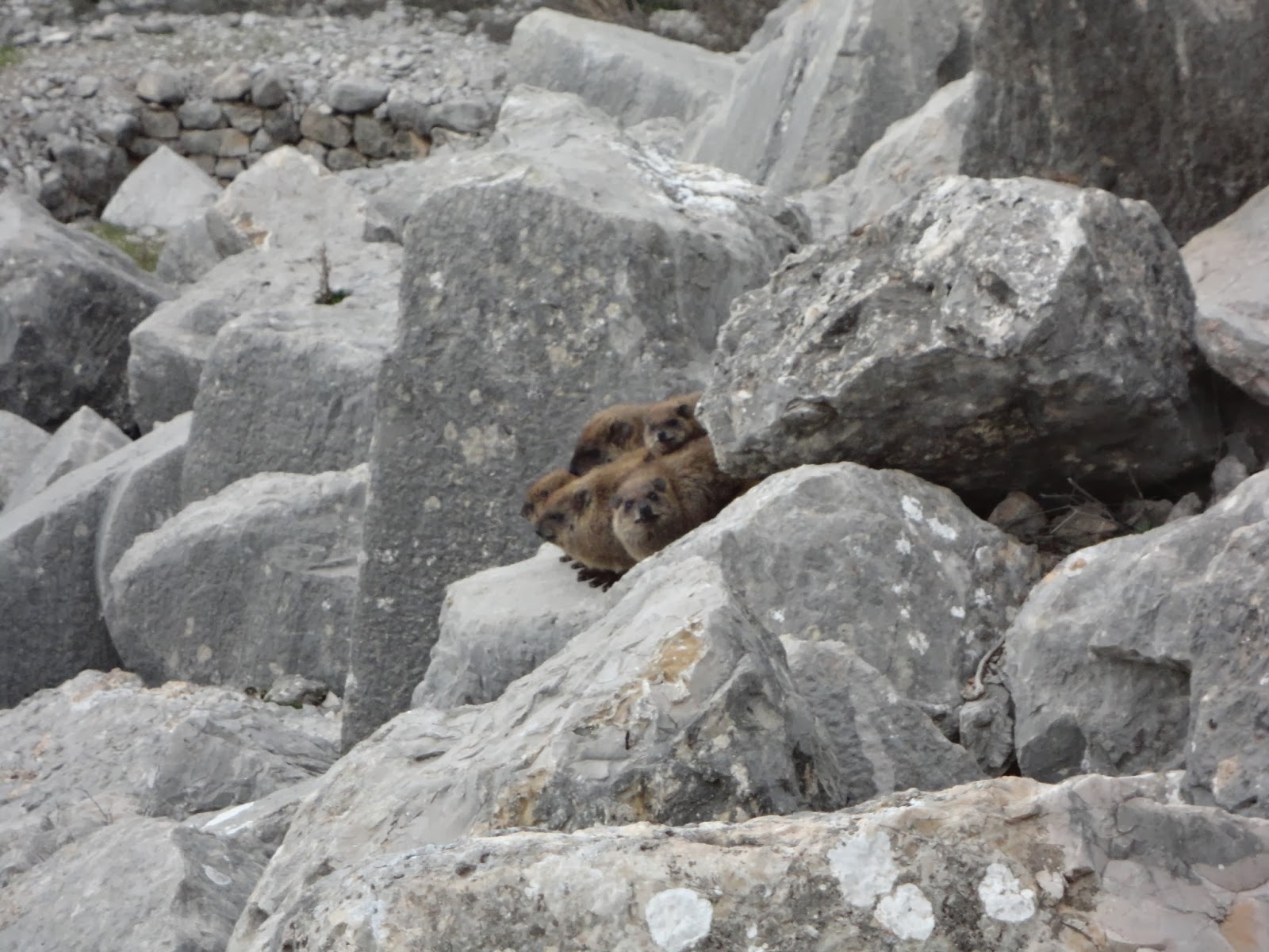


 s
s